Turtle Mountain Band of Chippewa Indians EPA Viewer

EPA Viewer screenshot
Turtle Mountain Band of Chippewa Indians EPA Viewer

Background

Since 1999, HEI has been serving tribal communities with environmental solutions, infrastructure services, water resources, water supply, funding assistance, planning, and more. Our experts are eager to serve Tribal communities across the region with fiscally responsible and quality environmental solutions that aim to improve people’s quality of life. One of the tribal communities we have a history of partnering with is the Turtle Mountain Band of Chippewa Indians (TMBCI).

The Project

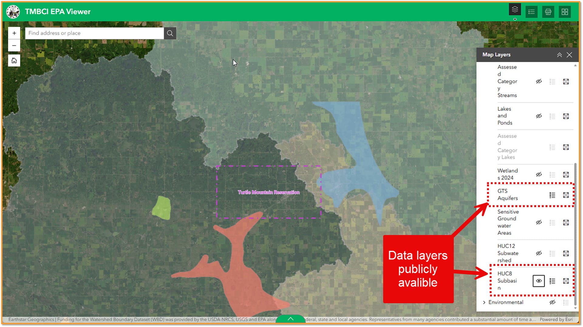
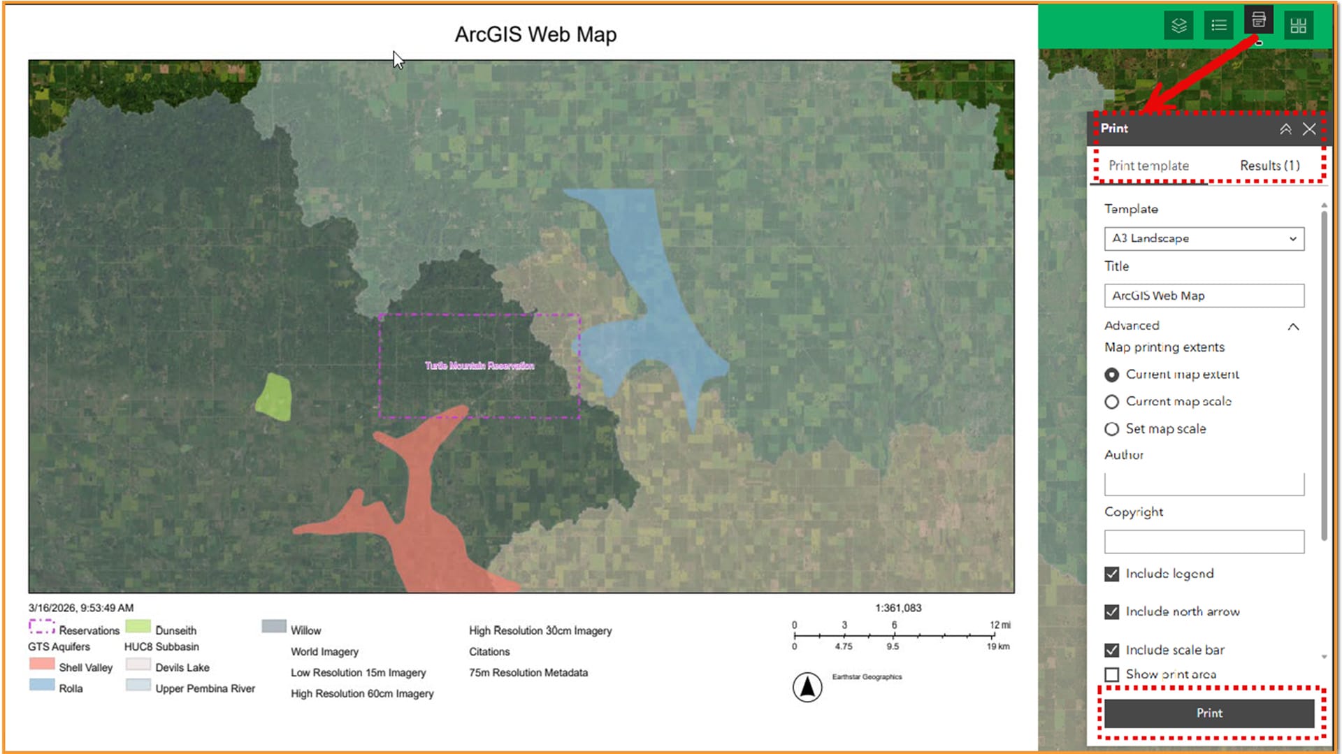
In the Summer of 2025, HEI built an EPA web viewer with ArcGIS Online’s Experience Builder. The Turtle Mountain Band of Chippewa Indians (TMBCI) had an old viewer that needed to be updated for public use. Taking data from the old viewer and gathering new and updated data was important to the TMBCI so the public could have the most updated information. The TMBCI EPA Viewer is a public website that the TMBCI members and others can us to see various environmental data within the Turtle Mountain reservation. We used the Esri ArcGIS Online Experience builder to develop this website. Many of the environmental layers used in the application were existing public layers from sources like the US Geological Survey. Other layers such as the wetland layers are from current TMBCI projects, in which wetland boundaries were defined based on new data like LiDAR. Surface water flowlines were also defined in this project. The TMBCI can use this EPA Viewer application to interact with the public and show various environmental factors that impact the Turtle Mountain reservation.


  • Utilizes ESRI Arc Online Experience Builder to develop the application.
  • Public facing application to show environmental resources within the Turtle Mountain Reservation.
  • Easy access for the Tribe to update layers and potential add new layers in the future.
Project Details

Location: Belcourt, ND

Project Highlights
  • Utilizes ESRI Arc Online Experience Builder to develop the application.
  • Public facing application to show environmental resources within the Turtle Mountain Reservation.
  • Easy access for the Tribe to update layers and potential add new layers in the future.
Services

Ready to start a project?

Get in touch with our Geospatial Technology experts today.

Related Projects

Web GIS Application for Disadvantaged Communities
View More
Statewide Recreation Mapping
View More
South Washington Watershed District Plan Update
View More
North Dakota Department of Health Surface Water Viewer
View More
Scroll to Top

Grant Research

We begin by thoroughly researching available grant opportunities to identify those best suited to your specific project needs. Our team leverages our deep understanding of federal, state, and local grant programs, as well as foundation grants, to ensure a comprehensive search. We evaluate eligibility criteria, funding priorities, and timelines to match your project with the most appropriate funding sources. This targeted approach maximizes the potential for securing financial support for your project.